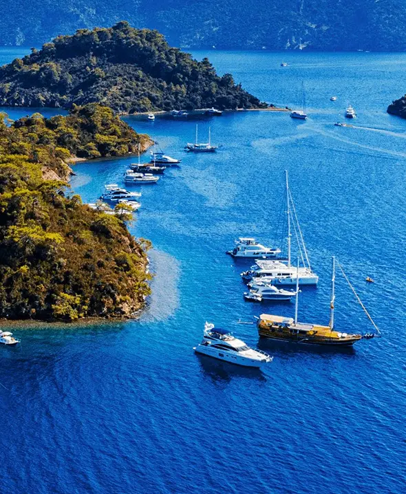
Itinerários de navegação — rotas dia a dia
ItineráriosRotas de navegação dia a dia

Itinerários de navegação.

Rotas semanais comprovadas pela Croácia, Grécia, Itália, Espanha, Turquia e Caraíbas. Siga o mapa dia a dia, confira as distâncias e escolha um barco na marina de partida da rota — tudo reservável online.

Zonas de navegação

Todas as rotas, por zona de navegação.

Escolha as águas certas para a sua semana — cada cartão abre todas as rotas a partir dessa base, dia a dia. Use-as tal como estão ou como ponto de partida; as escalas adaptam-se ao tempo e à sua tripulação.

Encontre o seu barco →

Croatia itinerários.

5 zonas
Split
9 rotas
Croatia · 7–14 dias

Zona de navegação Split

Split anchors the central Dalmatian charter market and pulls roughly two-thirds of all Croatian yacht bookings each season — for good reason. Marina Kaštela, ACI Trogir and Marina Baotić sit twenty minutes from the airport, the Roman-era Diocletian's Palace runs as the city's living downtown, and a single Saturday-to-Saturday week lets you reach Šolta, Brač, Hvar, Vis, Korčula and back without ever doing more than 25 nautical miles in a day. From Boat4You' Split base you can pick a sailboat for the classic family charter, a catamaran for stable two-cabin couples-and-kids weeks, a motor yacht for Costa Brava–style port hopping, or a fully crewed gulet for a hands-off luxury week. The Dalmatian middle islands suit every vessel type because the channels are sheltered, the bora and maestral arrive on predictable schedules, and the ports stack one Konoba lunch after another — Komiža on Vis, Stari Grad on Hvar, Vela Luka on Korčula. Two-week charters from Split typically run as a one-way to Dubrovnik via the Mljet National Park and the Pelješac peninsula. Shorter weeks loop back through the Kornati archipelago for visitors who prioritise raw landscape over town life. Whichever vessel and route you choose, the Split charter market offers the deepest fleet selection, the broadest skipper pool, and the most reliable charter logistics in the country.

Explorar as rotas de Split
Dubrovnik
7 rotas
Croatia · 7–14 dias

Zona de navegação Dubrovnik

Charters from Dubrovnik live and die by the southern flank of the Dalmatian coast — Mljet National Park 17 NM north, Lastovo 25 NM west, the Pelješac peninsula's wine villages a comfortable day-sail away. ACI Marina Dubrovnik (Komolac) and Marina Frapa Dubrovnik handle most of the fleet, with the airport at Čilipi twenty minutes south of both. Embarkation Saturday afternoons, return the following Saturday by 09:00 — same as the rest of Croatia, but with a noticeably calmer weather window than Split because you sit south of the bora's main reach. This base suits crews who want to start with the postcard view: Dubrovnik old town from the water, then sail to working fishing villages where charter traffic thins. Mljet's Polače and Pomena offer the only national park you can sail into in Croatia. Korčula's medieval old town and Hvar's Pakleni Islands are reachable for week-charter loops. Vessel mix from Dubrovnik leans toward sailing yachts and catamarans for couples and small families wanting the slow Adriatic pace, plus a strong motor yacht and crewed mega-yacht segment for guests flying in via Zagreb or Split with a private transfer. Fourteen-day charters frequently run as one-way Dubrovnik → Split via Mljet and Korčula, ending where the Dalmatian fleet density peaks.

Explorar as rotas de Dubrovnik
Sibenik
11 rotas
Croatia · 7–14 dias

Zona de navegação Sibenik

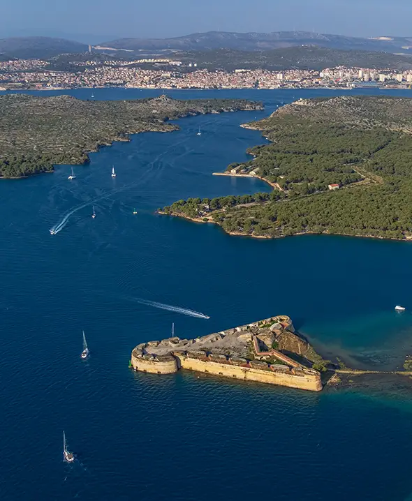
The Šibenik charter base is the gateway to Croatia's two best protected national parks — Kornati and Krka — both reachable in a single day-sail. Marina Mandalina, Marina Frapa Rogoznica and Marina D-Marin Mandalina take embarkation; the bus from Split airport reaches Šibenik in roughly 90 minutes, with private transfers cutting it to under an hour. Charter density is lower here than in Split or Trogir, which translates to less competition for moorings at popular anchorages and faster check-in lines on Saturdays. Šibenik's signature week is the Kornati loop: cross to the archipelago through Žirje, anchor in Levrnaka or Lavsa, and weave between the 89 uninhabited islands of the national park. Routes south to Hvar, Vis and Korčula go via Primošten — the prettiest bell-tower silhouette on the Croatian coast — and Rogoznica, a fishing-port harbour with one of the cheapest provisioning supermarkets on the coast. This base suits sailing-yacht and catamaran crews looking for raw landscape over town life, plus motor-yacht charters wanting a quieter Krka River entry (the only river-park sailing in Croatia, accessible to vessels under 6 m draft via the Skradin lock). Ideal for shoulder-season weeks (May–June, September) when the Kornati anchorages thin out.

Explorar as rotas de Sibenik
Istria
7 rotas
Croatia · 7–14 dias

Zona de navegação Istria

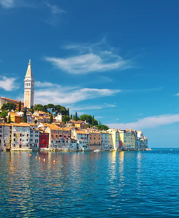
The Istrian charter market sits in northern Croatia and serves a different audience from Dalmatia: shorter passages between sheltered Kvarner Gulf islands, easier road access from Slovenia/Italy/Austria via Trieste or Ljubljana, and a culinary scene built on truffle, olive oil and Malvazija wine rather than Dalmatian seafood-and-wood-fire. Marina ACI Pula, Marina Pomer and Marina Punat (on Krk) handle most embarkations, with weekly check-in / check-out as in the rest of Croatia. A 7-day Istrian week typically loops from Pula past Brijuni National Park (former presidential summer residence, controlled-anchorage, a unique sailing-protected reserve), into the Kvarner via Cres, Lošinj and Rab, returning via Pag or back to Pomer. The Punat marina on Krk gives access to the Lošinj dolphin pods and Susak's red-sand beaches that stay quieter than south-Adriatic anchorages. Distances are short — most legs are 12–18 NM — and the maestral kicks in reliably around 14:00. Istria suits crews driving in from Central Europe, families with kids who want shorter daily passages, and food-focused charters wanting the truffle-region restaurants in Motovun and Grožnjan a short shore excursion from the marina.

Explorar as rotas de Istria
Zadar
12 rotas
Croatia · 7–14 dias

Zona de navegação Zadar

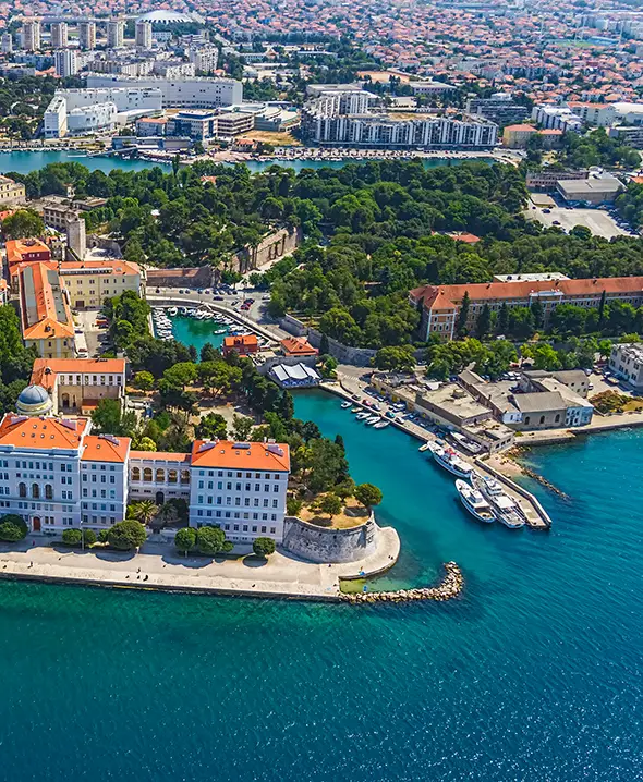
The Zadar charter cluster — Marina Sukošan, Marina Kornati Biograd, Marina Tankerkomerc Zadar — sits north of Šibenik and gives the most direct northbound route into Pag, Lošinj and the Kvarner Gulf, plus southbound access to the Kornati national park within 12 NM of departure. Zadar Airport handles direct flights from most European hubs in summer, and the road from Zagreb runs an easy 3 hours via the A1 motorway. Zadar's old town sits on a small peninsula with Roman ruins, a Venetian-era cathedral and the celebrated Sea Organ — a row of marble steps that sing when waves push air through underwater pipes. The marina cluster is residential rather than nightlife-driven, which suits crews wanting a calm Saturday embarkation. From here a 7-day week typically loops Kornati → Žirje → Krka → return; longer 14-day charters drop south to Hvar/Vis/Korčula or north to Lošinj and Cres. Strong vessel selection across sailing yachts, catamarans and motor yachts at all price tiers — Zadar's marina cluster has the deepest pure-bareboat fleet in Croatia after Split, with prices typically 5–10% lower than equivalent boats in Trogir. Excellent shoulder-season value because the bulk of charter pressure stays around Split.

Explorar as rotas de Zadar

Greece itinerários.

4 zonas
Cyclades
20 rotas
Greece · 7–14 dias

Zona de navegação Cyclades

The Cyclades are the most demanding charter ground in Greece — and the most photogenic. Bases at Athens (Alimos, Kalamaki, Lavrion) put you 30–45 NM from Kea on the first leg, and from there the meltemi (typically 4–6 Bft, peaking 7+ in late July/August) drives a southward arc through Kythnos, Serifos, Sifnos, Paros, Mykonos, Santorini and Ios. Charters that try to claw back north against the meltemi without time and patience get expensive in fuel and uncomfortable in passages — the conventional one-way drop in Paros or Mykonos solves both. Vessel mix in the Cyclades runs heavy on monohull sailing yachts (45–55 ft) because they handle the meltemi better than catamarans on close-reach upwind legs. Catamarans excel for crews staying in the more-protected southern Cyclades cluster (Sifnos, Folegandros, Milos) where the wind angle is mostly downwind. Motor yachts and crewed luxury yachts dominate the Mykonos–Santorini party charter market. Best season is May–June and September — meltemi blows lighter, town anchorages are uncrowded, water temperature stays swimmable, and prices drop 30–40% vs August peak. The Cyclades reward experienced skippers; first-time bareboaters typically pick the gentler Ionian first.

Explorar as rotas de Cyclades
Ionian
9 rotas
Greece · 7–14 dias

Zona de navegação Ionian

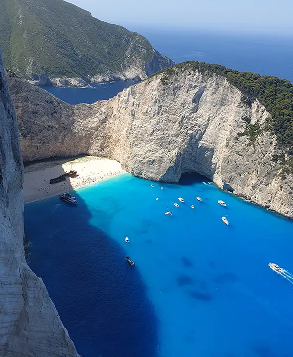
The Ionian Sea is the gentlest charter ground in Greece — protected channels between Lefkada, Kefalonia, Ithaca and Meganisi, light afternoon thermals (rarely above 5 Bft), and a chain of small fishing-village ports where charter pressure is much lower than the Cyclades. Lefkada (Marina Lefkas) and Corfu (Marina Gouvia) handle the bulk of bareboat embarkations; Preveza on the mainland is third. Distances are shorter — most legs are 8–18 NM — and almost everything is line-of-sight, which makes this the best Greek charter base for first-time skippers and families with young kids. A 7-day Ionian week typically runs Lefkas → Meganisi → Kalamos → Kastos → Ithaca → Kefalonia (Sami or Fiscardo) → Skorpios anchorage → return. Corfu charters loop south to Paxos / Antipaxos and Parga on the mainland; longer 14-day weeks cross to Zakynthos for the famous Shipwreck Bay. The food is a different Greek cuisine to the Cyclades — heavier on olive oil, less on fish — and the Ionian villages tend to keep traditional working harbours open year-round rather than tourist-only marinas. Suits all vessel types but particularly catamarans (downwind summer routes, shallow stern-to anchoring) and crewed gulets (Corfu-Lefkas one-way deliveries are common). Best season is May–early July and September; August brings family-tourism crowds but never the Cyclades heat.

Explorar as rotas de Ionian
Sporades
3 rotas
Greece · 7–14 dias

Zona de navegação Sporades

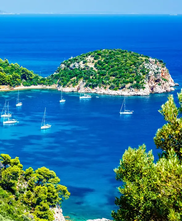
The Sporades sit in the central-Aegean cluster between mainland Greece and the Northern Aegean — Skiathos, Skopelos, Alonissos and the Marine National Park of Alonissos. Charters depart from Skiathos Marina (the standout commercial base, 5 minutes from Skiathos airport JSI with direct EU flights April through October) or from Volos on the mainland (a 90 NM transit from Athens that lands the same fleet at 20–30% lower weekly rates — worth it for charters with one-way time or budget pressure). The chain is short enough that a 7-day week comfortably covers the four main islands without one-way logistics, with passages typically 15–25 NM and harbour density allowing every-night-in-port if the crew wants it. Two factors set the Sporades apart from the rest of Greece. First, the meltemi reaches here only in moderated form — typically 3–4 Bft on the protected southwest sides, occasional 5 Bft on the exposed eastern beaches — making this the second-gentlest Greek charter ground after the Ionian and the obvious first-week pick for crews moving up from light-wind cruising grounds. Second, the Northern Sporades National Marine Park (Greece's first marine reserve, established 1992) covers waters around Alonissos and offers reliable Mediterranean monk seal sightings — a critically endangered species with one of its last viable Mediterranean populations here. Mooring inside the park requires advance permits handled by the charter base; a ranger-piloted patrol enforces the no-anchor zones. Classic 7-day week from Skiathos: Day 1 short hop to Tsougria for the shake-down swim and lunch, Day 2 across to Skopelos town (the harbour the Mamma Mia! film made famous — yes, the church scenes are filmed at Agios Ioannis on the eastern side, sailable from Skopelos), Day 3 Alonissos's Patitiri with a Marine Park boat-tour booking for monk-seal waters, Day 4 lay-day Alonissos or shore-side hike up to the Old Town (Chora), Day 5 west to Glossa on Skopelos's north tip, Day 6 back to Skiathos via Koukounaries beach, Day 7 return. Total roughly 90 NM over the week. Vessel mix runs catamarans (Lagoon 40-46, Bali 4.2) for families and crews wanting stable anchoring at shallow Tsougria-style coves; sailing yachts (40–50 ft Bavarias, Jeanneaus, Bénéteaus) for sailing-first crews; small motor cruisers in the 35–45 ft range for cooler-week charters. Gulet weeks run from the mainland (Volos) but the Sporades fleet is more bareboat-and-skippered than gulet. Best season May–early July and September. May has the lightest wind and smallest crowds (water 19–21 °C, swimmable but cool). September brings the warmest swim (23–24 °C) with the meltemi already retreating. July is hot and crowded around Skiathos town nightlife (and the Mamma Mia! day-trip traffic on Skopelos), August is full-rate with Skiathos airport gridlocked Saturday — avoid if possible. Pine-forested island slopes, traditional fishing-village ports (Skopelos town and Alonissos's Patitiri stand out), and shallow turquoise anchorages around Tsougria suit families with kids, first-Med crews, and nature-and-culture-focused charters wanting an alternative to the meltemi pressure of the Cyclades. Skiathos itself has 60+ beaches catalogued by the tourism board — Koukounaries, Lalaria (accessible only by boat from the north coast), Mandraki and Banana Bay are the standout swim stops.

Explorar as rotas de Sporades
Dodecanese
4 rotas
Greece · 7–14 dias

Zona de navegação Dodecanese

The Dodecanese is the eastern Aegean charter chain — twelve major islands hugging the Turkish coast, with Rhodes (RHO airport) and Kos (KGS) as primary embarkation marinas. The proximity to Turkey opens up cross-border one-way charters: Bodrum → Rhodes via Symi (Greek port-of-entry checkpoint at Symi) is a popular 7-day delivery format, and Bodrum → Kos via Kalymnos is the shorter cross-border option for crews wanting a half-Turkish half-Greek week. The cluster's southern position keeps the meltemi noticeably softer than the Cyclades while still providing reliable 3–5 Bft afternoon sailing wind. Two embarkation models work here. From Rhodes the standard week runs north through Symi (the most photographed neoclassical-painted harbour in Greece, with the famous façade-painted town climbing the bowl behind the port), then Tilos (a Special Protection Area for migratory birds — 100+ species in spring/autumn), Nisyros (an active volcano with a sailable caldera and the Stefanos crater walkable from Mandraki port), and back via Chalki. Total roughly 90 NM, sheltered passages, good harbour overnight options. From Kos the typical loop covers Patmos (the Cave of the Apocalypse, where John of Patmos wrote Revelation — UNESCO site, walkable from Skala port), Leros (Lakki harbour, Italian-built art-deco port from the 1930s), Lipsi (the quietest taverna island in the Dodecanese — 800 inhabitants, three small ports), and Kalymnos (historically the Mediterranean's sponge-diving centre, today better known as a world-class climbing destination with 3,400+ bolted routes on the limestone cliffs above Massouri). Distances are moderate (15–25 NM legs) and harbour density is high, so even slower-paced crews comfortably hit 5–6 islands in a week. Symi gets its own paragraph. The Italian-period (1912–1947) facades give Symi the postcard architecture you saw on the brochure — yellow, terracotta, ochre, mostly preserved because the Greek Government protected the island as a historic settlement. Anchoring options are limited; book a Symi harbour quay slot 48 hours ahead through the charter base in peak season or anchor outside in Pedi bay (3 NM east) and tender in. Symi's restaurant standout is Tholos at the harbour's south end — fresh fish, run by the same family for 40+ years. Vessel mix suits all formats equally — sailing yachts (Bavaria, Bénéteau, Jeanneau 40–50 ft) for sailing-first crews, catamarans (Lagoon 42-46, Bali 4.4) for families and groups, motor yachts for shorter charter weeks combining a couple of overnight stops with longer marina stays, and gulet weeks for the Turkish-coast crossover routes. Crewed luxury yachts (50–100+ ft) work the Rhodes-Symi-Bodrum corridor as a premium segment. Best season May–early July and September. Rhodes and Kos airports both have direct EU flights all summer (Rhodes from London/Manchester/Berlin/Vienna/Stockholm/Milan/Rome, Kos slightly fewer routes), making Saturday-afternoon arrivals straightforward. October is still sailable but Rhodes's tourist crowds thin sharply after mid-September. Greek cruising-fee taxes (TEPAI) apply per yacht per day for all charters — the broker pre-pays them out of the APA, so they appear as a transparent line item on the charter accounting, not a surprise at check-out. Cross-border to Turkey requires transit log paperwork lodged 24 hours ahead at the port-of-entry checkpoint (Rhodes, Kos or Symi southbound; Bodrum northbound).

Explorar as rotas de Dodecanese

Turkey itinerários.

2 zonas
Bodrum
4 rotas
Turkey · 7–14 dias

Zona de navegação Bodrum

Bodrum is the western embarkation hub for Turkish yacht charters — Yalıkavak Marina (the largest superyacht marina in the eastern Mediterranean, 400+ berths, the Med's busiest 60+ m yacht cluster after Antibes), Turgutreis Marina (the bareboat fleet centre, lower overnight rates and fast access to the western anchorages), and Bodrum's own Marmara Marina inside the castle bay (closest to Bodrum Old Town, walking distance to the Mausoleum at Halicarnassus). All three handle embarkation; Milas-Bodrum airport (BJV) is 35 minutes north and runs direct EU flights April through October. The Gulf of Gökova south of Bodrum is the standout itinerary: 25 NM of protected anchorages between Cleopatra (Sedir) Island — the legend says Cleopatra's white-sand beach was imported here from Egypt for her, and the sand grain analysis genuinely matches a North African source — Bencik, Longoz, Çökertme, English Harbour and Karacasöğüt. The Gulf is walled by 800 m mountains on three sides, so the meltemi blows in at the entrance but the inner two-thirds stays sheltered even on strong-wind days. Most evenings end with the boat moored stern-to a tree on the shore (a Turkish charter signature — the partner agency provides the marlin line, the captain rigs it), the restaurant launch comes out to collect the crew, and dinner runs ashore at a family-run dock-side meyhane. Bodrum's signature pull is the Turkish gulet — traditional wooden motor-sailers (typically 20–40 m, 6–12 cabins) with full crew (captain, chef, hostess, deckhand) at all-inclusive pricing 30–40% below equivalent crewed yachts in Croatia or Greece. The gulet market dominates the Turkish charter scene, but the bareboat segment is growing: sailing yachts (Bavaria, Sun Odyssey, Hanse 40–50 ft) and catamarans (Lagoon 42-50, Bali 4.4-5.4, Leopard 45) are available in increasing numbers from Turgutreis and Bodrum bases. The motor yacht segment serves the Yalıkavak superyacht scene — 30 m+ Westport, Princess and Sunseeker hulls, weekly rates €40,000+. The standard 7-day Bodrum loop runs counter-clockwise into Gökova: Day 1 short hop to Karaada (Black Island, swim/snorkel stop 4 NM south of Bodrum harbour), Day 2 into the Gulf to Cleopatra/Sedir, Day 3 deeper to Çökertme (with the famous shore-side restaurant cluster), Day 4 lay-day at Çökertme or onward to English Harbour, Day 5 Karacasöğüt for Wednesday night fish dinner, Day 6 return via Akbük and the Bodrum peninsula coves, Day 7 base. Roughly 110 NM total, almost all sheltered. Cross-border one-ways are popular: Bodrum → Kos (one-day delivery to the Greek Dodecanese) is the easiest way to combine Turkish and Greek sailing in 14 days. The transit log filing runs 24 hours ahead at the port-of-entry checkpoint, broker handles it. The southbound version (Kos → Bodrum) also works for crews wanting the cheaper-overall Turkish hospitality side after a meltemi week. The Turkish season runs longest of all Mediterranean grounds — April through early November — with August Bodrum heat (35–38 °C onshore) being the only real downside. May, June, September and October are the broker's preferred windows: water 22–25 °C, light afternoon meltemi 3–4 Bft, the marinas reachable without pre-booking. Turkish cuisine at Çökertme, Karacasöğüt and Kapı Creek meyhanes is a charter draw of its own — meze plates, raki, fresh-caught fish grilled simply, prices roughly half of comparable Greek tavernas. Permits and paperwork: Turkish charter agencies handle the transit log, marina fees, fishing-licence-where-needed, and the Turkish VAT-equivalent (KDV) on the charter base price (already in the broker quote). National Park entry fees apply to Saklıkent Gorge inland excursions if the crew wants the shore tour, but Gökova is a Special Environmental Protection Area, not a fee-charged National Park.

Explorar as rotas de Bodrum
Cyclades
4 rotas
Turkey · 7–14 dias

Zona de navegação Gocek

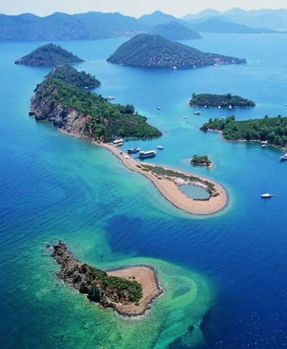
Göcek is the eastern Turkish charter base — D-Marin Göcek, Skopea Marina and Marinturk Village Port between them handle the bulk of embarkations, with Dalaman airport (DLM) 15 minutes north and running direct EU flights April through October from London, Manchester, Berlin, Vienna, Brussels, Amsterdam and most major German hubs. Göcek itself is a small town built around the marinas; most charterers see only the marina, the chandlery and the first restaurant on the way back to the boat, but the village holds its own and the Sunday morning markets are worth the 10-minute walk inland. Göcek's signature is the "12 Islands" — a cluster of pine-backed islets and protected bays inside Fethiye Bay where most of a 7-day week unfolds without ever leaving the inner waters. Cleopatra's Baths (Hammam Bay, with the Roman-era stone hammam ruins visible underwater at the back of the bay), Tomb Bay (Lycian rock-cut tombs in the cliff face above the anchorage), Wall Bay (named for the ancient harbour wall), Sarsala, Kapı Creek and Boynuzbükü are the canonical stops. The protected geography means the meltemi blows over the top of the surrounding hills but the anchorages stay calm — most evenings the only sound at anchor is the cicadas and the launch tenders moving between yachts and shore-side restaurants. Classic 7-day inner-loop: Day 1 short hop to Hammam Bay for the shake-down lunch and snorkel over the underwater ruins, Day 2 to Tomb Bay with the rock-tomb hike in the late afternoon, Day 3 lay-day at Wall Bay or onward to Sarsala for the long swim-bay, Day 4 Boynuzbükü (the "horn bay") with the famous Olive Garden taverna ashore, Day 5 Kapı Creek night-end stern-to-tree mooring with dinner at one of the three family tavernas, Day 6 short trip across to Ruin Bay, Day 7 return via Tersane Island. Total 60–80 NM over the week — small daily passages and shallow anchorages everywhere. Longer 10–14 day routes head east along the Lycian Coast through Fethiye, Ölüdeniz (the lagoon visible from the air on the approach to Dalaman), Butterfly Valley (anchorage outside, beach inside reachable by tender or footpath only — no road), Kaş (the standout Lycian-coast town, walkable to Hellenistic ruins), Kekova (sunken Lycian city, ruins partially submerged and visible through a glass-bottom tender), Demre (Saint Nicholas's church, the original Father Christmas — Lycian Myra), and Çıralı with the active Mount Chimaera natural-gas flames burning out of the rock-face above the beach (sailable approach, walkable inland from the anchorage). Phaselis and Olympos give two more Lycian-era harbour ruins on the same coast. The Lycian Coast offers Turkey's deepest archaeological sailing — more identifiable ancient harbour ruins, more rock-cut tombs, more visible submerged classical-period structures than any other Mediterranean charter ground. Crews more interested in culture than party-week beach scenes consistently rank the Lycian Coast their favourite. The added passage time is 15–35 NM legs (vs Göcek's 5–15 NM inner loop), so the 14-day format works better than trying to compress it into 7 days. Göcek itself sits inside a strict Special Environmental Protection Area — no jet-ski, no anchoring damage to seagrass, no fishing in marked zones — which keeps the inner Fethiye Bay anchorages in better shape than the Adriatic or Spanish equivalents at peak season. The protection authority occasionally inspects yachts at anchor; the broker briefs the captain on which bays have stricter enforcement. Vessel mix is a strong gulet market (the Göcek–Fethiye one-way "Blue Cruise" is the most traditional Turkish charter format — 20–35 m wooden motor-sailers with full crew, all-inclusive pricing) plus a growing bareboat catamaran and sailing yacht segment from Skopea and D-Marin. Crewed luxury motor yachts run the Yalıkavak-Göcek long-haul corridor and the eastbound Lycian-Coast 14-day weeks. Best season May–early July and September–October. The Turkish season runs Apr–Nov, longer than any other Mediterranean ground; August Göcek heat (33–36 °C onshore) and the marina full-book situation are the only real downside. Permits, transit logs and Turkish-side regulatory paperwork are all handled by the partner agency in the booking quote.

Explorar as rotas de Gocek

Spain itinerários.

3 zonas
Catalonia
5 rotas
Spain · 7–14 dias

Zona de navegação Catalonia

The Catalan coast — Costa Brava in the north (240 km of cliff-and-cove coastline from Blanes to the French border), Barcelona's Port Olímpic / Port Vell in the centre, Sitges and the Costa Daurada south — gives charters the easiest big-city embarkation in Spain. Direct EU flights into Barcelona-El Prat (BCN) make Saturday-afternoon check-in painless from London, Manchester, Dublin, Paris, Berlin, Munich, Vienna, Amsterdam, Brussels, Zürich, Geneva, Stockholm, Milan and Rome year-round. The marina cluster around Port Forum, Port Vell and Marina Vela handles the bulk of bareboat departures; Marina 92 and Port Ginesta (15 km south at Sitges) are the bareboat-friendly alternatives with lower overnight rates. From the Barcelona embarkation a 7-day week typically heads north along the Costa Brava — Day 1 short hop to Sitges (the standout shore-evening town, walkable from Port Ginesta), Day 2 longer leg to Palamós (the langoustine port — Palamós shrimp Gambas de Palamós is a Spanish DO product, the cooperative on the harbour serves the morning auction), Day 3 onward to L'Escala (anchovies-and-Roman-ruins, Empúries archaeological park 10 minutes from the marina), Day 4 Roses (the wide protected anchorage and the foothills of the Pyrenees rising behind), Day 5 Cadaqués (Salvador Dalí country, the most photographed cove village in Catalonia — the Dalí house at Portlligat is walkable), Day 6 Cap de Creus (the easternmost point of the Iberian peninsula, dramatic schist-rock coastline, Cap de Creus Natural Park with multiple cove anchorages), Day 7 return south via Aiguablava and Tossa de Mar. Roughly 130 NM total. The unique pull of Catalonia is what's ashore. Barcelona's Gothic Quarter, Gaudí's Sagrada Família, Park Güell, Casa Batlló and Palau de la Música are all reachable as half-day stops from Port Vell (walking distance to most). The Costa Brava restaurants give Spanish charters Catalonia's standout meals — Empordà cuisine (suquet de peix, sea-and-mountain stews, escalivada), the Roca brothers' three-Michelin Celler de Can Roca influence (the daughter restaurants and trained-by-the-Rocas alumni populate the small Empordà towns), and the standout dock-side bistros at Palamós and L'Escala. Wine pairings move through the Empordà DO whites (Garnatxa Blanca, Macabeu) and the Penedès region's cavas south of Barcelona. Cap de Creus and the Aiguamolls Natural Park deserve their own paragraph. The Cap de Creus Natural Park (Spain's first marine-and-terrestrial combined Natural Park) protects the rocky north Catalan tip — the schist-cliff anchorages, the wind-twisted vegetation that inspired Dalí's surrealist landscapes, and the underwater ecology around Roses Bay. Aiguamolls Natural Park (just south of Roses) is the bird-migration wetland — flamingos, herons, storks visible from the boat at the right season (April-May and September-October). The summer thermal-wind pattern is reliable (5–7 Bft most afternoons, light morning calm) and the water clarity in the Costa Brava coves matches the Balearics (8–12 m visibility on a settled day). Crowds stay below the Ibiza/Mallorca summer pressure — the Costa Brava coves rarely have more than 5–10 boats at any single anchorage even in August, and Cap de Creus often has the bay to your crew and one other yacht. Catalonia suits motor yachts (the Barcelona harbour and the Costa Brava cove combination works well for shore-evening-heavy charters) and sailing yachts (45–50 ft Bavarias and Jeanneaus dominate the bareboat fleet — the reliable thermals make sailing-first weeks rewarding). Catamaran demand is lower here than the Balearics; the cluster has fewer than the Ibiza/Mallorca corner can offer. Crewed luxury yachts (50+ ft) work the Barcelona-Sitges-Palamós shore-evening circuit. Best season May–early July and September. August Barcelona heat (32–35 °C onshore) and tourist-density are the trade-off for peak weather; many crews start or end in Barcelona but spend the bulk of the week 60+ NM north up the Costa Brava where the city density disappears. May has the lightest crowds and the cooler swim (water 19–21 °C); September is the broker's preferred window — water 23–24 °C, light afternoon thermals, restaurants reopening from their late-August closure. The Tramuntana wind risk is the one weather caveat. A few times per season a Pyrenean front sends a north-east 7–8 Bft Tramuntana down the Costa Brava — pins the fleet in for 24 hours typically (the Costa Brava harbours all have safe enough overnight protection). The captain reads the forecast 48 hours ahead and reroutes south if needed. Spring shoulder weeks (May, early June) carry higher Tramuntana risk than late summer.

Explorar as rotas de Catalonia
Ibiza
2 rotas
Spain · 7–14 dias

Zona de navegação Ibiza

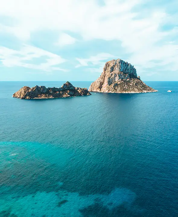
Ibiza sits 80 NM south of Mallorca and 4 NM north of Formentera, at the western edge of the Balearic chain. The island runs roughly 41 km north-south and 25 km east-west — the whole coastline is reachable in a 7-day charter without ever clocking more than a 20 NM day. Three embarkation marinas serve the charter fleet: Marina Ibiza in Ibiza Town (300+ berths, the megayacht cluster, walking distance to the Old Town and beach-club transfers), Marina Botafoch (the upscale alternative on the north side of the harbour, slightly quieter), and Sant Antoni on the west coast (smaller, faster access to Cala Conta and Es Vedrà, lower mooring fees). Ibiza Airport (IBZ) is 15 minutes from Ibiza Town and 25 from Sant Antoni; direct flights run April through October from London, Manchester, Paris, Milan, Munich, Zürich, Amsterdam and most major EU hubs. The classic 7-day week from Ibiza Town runs counter-clockwise: Day 1 short hop to Talamanca for the shake-down swim, Day 2 cross to Formentera (Cala Saona, Espalmador), Day 3 stay on Formentera (Illetes + Llevant beaches on the north tip), Day 4 jump back to Cala Jondal or Cala Bassa for the beach-club afternoon, Day 5 round Es Vedrà to Cala d'Hort and Cala Comte, Day 6 north to Sant Antoni and Cala Salada, Day 7 return down the west coast to base. Total distance roughly 80 NM over the week — small daily passages, prevailing south-westerly afternoon breeze, sheltered anchorages at every stop. Bareboat crews with one or two seasons of Med experience handle it comfortably. Two distinct charter audiences come to Ibiza. The first is the high-end party-week crowd — motor yachts and crewed luxury yachts in the 50–100+ ft range, anchoring off Salinas or Cala Jondal for Blue Marlin, Nikki Beach or Beachouse afternoons, mooring at Marina Ibiza overnight, and budgeting €150,000+ for the full week (yacht, crew, fuel, beach-club tabs). The second is the Formentera-and-coves crew on bareboat catamarans (Lagoon 42, Bali 4.6, Leopard 45) wanting clear-water anchorages, minimal crowds, and a per-week budget closer to €10,000–18,000 base. Sailing monohulls work for either group, but party-week dynamics push most of the segment toward catamarans for the stable hull under load at busy beach-clubs. Formentera deserves its own paragraph. The island is a protected Natural Park, the Posidonia seagrass meadows around it are a UNESCO World Heritage marine ecosystem, and anchoring restrictions are real and enforced. Espalmador (the small island off Formentera's north tip) requires a mooring permit booked through the Govern de les Illes Balears (€20–50 per night, opens 30 days ahead, books out by early May for July-August). Illetes and Llevant beaches have designated buoy zones — drop anchor outside the buoys and the Park inspector boat will move you within the hour. The reward is some of the clearest water in the western Mediterranean (12–15 m visibility on a settled day) and the white-sand backdrop the brochure pictures actually deliver. Es Vedrà — the 380 m limestone needle 2 NM off Ibiza's south-west coast — is the iconic Ibiza anchorage. Day-time swim stop only; the swell builds at sunset and the holding is patchy, so don't plan to overnight there. Run inshore to Cala d'Hort or Cala Llentrisca for the sleep. The Es Vedrà sunset from a yacht deck is the closest the Mediterranean comes to a guaranteed photograph — the catamaran fleet drifts together off the south side from 19:00 onwards in summer. Best season is May–early July and September. July is hot and the marinas fill; August is full-rate everywhere — Marina Ibiza peak nightly fees hit €150–250 for a 45 ft yacht, the beach-club sun-bed minimum spend runs €100+, and Espalmador buoys are gone two weeks before you ask. September drops the same yacht to €80–120/night, water stays 23–24 °C, and the queue at Es Vedrà thins to a handful. May has the lightest wind and the smallest crowds but cooler water (19–21 °C) — best for couples and families more interested in the cruising than the swim. Weather pattern: prevailing south-westerly afternoon breeze 3–5 Bft (10–18 kt), light morning calm, occasional Tramuntana from the north when a Pyrenean front pushes through — pins the fleet in for 24 hours typically. Autumn storms can be sudden from mid-October; charter season effectively closes November–April. VHF Ch 16 monitored 24/7 by Salvamento Marítimo (Tarragona MRCC); the broker's emergency cycle wakes a duty captain in Palma if a partner-side issue lands outside business hours.

Explorar as rotas de Ibiza
Mallorca
5 rotas
Spain · 7–14 dias

Zona de navegação Mallorca

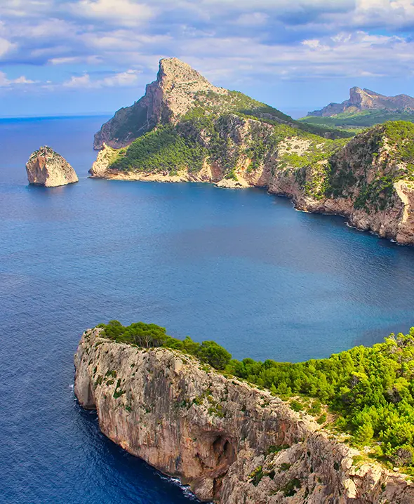
Mallorca is the largest Balearic and the most balanced charter ground in the western Mediterranean — Palma's deep marina cluster (Marina Port de Mallorca, Real Club Náutico de Palma, Marina Naviera Balear, Club de Mar, STP) gives the broadest fleet selection in Spain by berth count, the southern and eastern coasts have the cove-and-cala anchorages (Cala Pi, Cala Mondragó, Cala Figuera, Cala d'Or, Porto Petro), the Cabrera National Park sits 8 NM south of the Cap de Salinas tip, and the western Tramuntana coast offers dramatic cliff-backed sailing past Sa Calobra and Port de Sóller. Direct EU flights into Palma airport (PMI — Spain's third-busiest after MAD and BCN) make Saturday-afternoon embarkation effortless from London, Manchester, Dublin, Paris, Berlin, Munich, Vienna, Amsterdam, Zürich, Geneva, Stockholm, Copenhagen and most major Italian hubs. A 7-day Mallorca week typically runs counter-clockwise from Palma: Day 1 short hop to Sa Rapita or El Arenal for the shake-down swim, Day 2 across to Cabrera National Park (overnight buoy permit required, controlled-anchorage marine park — see paragraph below), Day 3 east-coast climb to Porto Petro and Cala d'Or, Day 4 lay-day at Mondragó or Cala Llombards, Day 5 north to Porto Cristo (the Coves del Drac stalactite caves are a worthwhile shore-half-day), Day 6 Cala Ratjada or Capdepera at the northeastern tip, Day 7 return via Cala Bona and Cala Millor or the long sail back along the east coast. Total roughly 110 NM. The northern route runs counter-clockwise via the Tramuntana coast: Palma → Andratx and Sant Telm (sail past Sa Dragonera island), then north up the rocky west coast to Port de Sóller (the standout north-coast harbour, walkable to the Sóller town centre via the historic wooden tram), Sa Calobra (the canyon-mouth anchorage at the foot of the Torrent de Pareis gorge), Cap Formentor (the northernmost tip of Mallorca with the Formentor lighthouse), Pollença Bay, then back south via Alcúdia and the east coast. Heavier sailing, more dramatic scenery, more demand on skipper experience — the west coast doesn't have many bail-out harbours if the Tramuntana wind shifts. Cabrera National Park deserves its own paragraph. The 19-island archipelago 8 NM south of Mallorca was designated Spain's first National Park (1991 — terrestrial and marine combined). The whole area is permit-controlled: anchoring outside designated mooring zones is prohibited, the Park boundary is patrolled by Park rangers, and the 50 mooring buoys in the main bay (Es Port) book out for July-August by mid-May. Reservations open online 30 days ahead through the Govern de les Illes Balears Park reservation system; the partner agency in Palma handles the booking as part of pre-charter setup. The reward: water clarity that the Balearics' developed coastline can't match, with the Posidonia seagrass meadows and a Roman-period wreck visible to 30+ m depth on a settled day. Vessel mix is the most diverse in Spain — sailing yachts (Bavaria, Jeanneau, Bénéteau, Hanse 40–55 ft), catamarans (Lagoon 42-50, Bali 4.4-5.4, Leopard 45 — excellent for Cabrera and Mondragó shallow-bottom anchorages), motor yachts (Princess, Sunseeker, Azimut, Pershing 40–70 ft — the Palma marina scene rivals Costa Smeralda in megayacht concentration), and a strong crewed luxury yacht segment in the 50+ ft range serving the Mallorca-Menorca-Ibiza Balearic-triangle market. Crewed mega yachts (30+ m) launch from STP and Marina Port de Mallorca as the home base for the western-Med summer season. Best season May–early July and September. The Tramuntana wind from the north-west builds in winter and shoulder seasons (genuinely dangerous in late autumn — the season effectively closes mid-November); summer is settled with reliable south-westerly afternoon thermals 3–5 Bft. July–August brings family-tourism crowds (PMI airport at peak capacity, the Palma harbour at full-night-fee €130–250 for a 45 ft yacht), but Mallorca handles them better than Ibiza — the cove network is dense enough that even peak August has empty bays within 10 NM of any port. May has the smallest crowds and the cooler swim; September is the broker's preferred window — water 24 °C, water clarity at peak, Tramuntana risk still moderate. Mallorcan cuisine is a charter draw — sobrassada (the soft cured pork spread), ensaïmada (the spiral coiled pastry, eaten at breakfast), tumbet (the layered aubergine and potato), Mahón cheese (technically from Menorca but ubiquitous on the Mallorcan tables), and Binissalem DO red wines from the centre of the island. Marina-side dining at Puerto Portals (high-end west of Palma) and Port d'Andratx delivers consistent quality; the village trattorie at Deià (Sa Foradada cove restaurant, only reachable by boat or by 45-minute hike) and Sóller (Béns d'Avall, the standout Tramuntana-coast establishment) are the gastronomic anchors of the western route.

Explorar as rotas de Mallorca

Italy itinerários.

3 zonas
Amalfi
6 rotas
Italy · 7–14 dias

Zona de navegação Amalfi

The Amalfi Coast and the Gulf of Naples form Italy's most photographed charter ground — a 50-NM crescent of cliffside villages (Positano, Amalfi, Ravello, Praiano, Atrani, Cetara, Maiori, Minori, Furore), the islands of Capri, Ischia and Procida, and the Sorrento peninsula's pastel ports. Charters launch from Marina di Stabia (Castellammare, 30 minutes from Naples airport NAP), from Sorrento (15 minutes further south on the peninsula, smaller marina but walkable to the town centre), or from Salerno on the south side of the peninsula (the standout for crews wanting to start the loop at Amalfi-town itself or extending south toward Cilento). Northern long-week one-ways launch from Genoa or Lavagna, adding the Cinque Terre, Portofino, Portovenere and the upper Tyrrhenian to the standard Amalfi route. The Tyrrhenian here is small-distance sailing — most legs are 10–20 NM — but charter logistics are dense (advance mooring booking is essential in July–August at every Amalfi-coast port; the harbour at Positano is too small to handle drop-in arrivals at peak season, and the Marina Piccola anchorage at Capri can be standing-room-only by late morning). The classic 7-day Amalfi week from Marina di Stabia loops Sorrento → Capri (overnight at Marina Grande or anchor at Marina Piccola) → Positano → Amalfi-town → Praiano → Maiori → Cetara → return; alternative weeks add Ischia (the larger and quieter sister to Capri, with the Aragonese Castle approach and Sant'Angelo on the south side) and Procida (the smallest and most photogenic island of the trio, Italy's 2022 Capital of Culture). What separates Amalfi from other Italian charter regions is the food. Campania cuisine peaks at the seaside trattorie of Praiano (La Brace, La Tagliata for the multi-course view-meal), Cetara (Acquapazza for the colatura di alici, Cetara's anchovy-sauce DOC), and Marina del Cantone (Lo Scoglio, the Pasta family's tomato-and-zucchini-pasta institution since 1953 — Stanley Tucci puts it on the show). The Sorrento limoncello distilleries (I Giardini di Cataldo, Limonoro) sell direct from the lemon-grove production sites; Capri's Da Paolino lemon-grove restaurant — the canopy-of-lemon-trees roof — sets the gastronomic standard for Mediterranean dining. Ischia delivers the Campanian volcanic-soil wines (Biancolella, Forastera) and the Negombo thermal-spring spa for a charter rest day. Positano, Amalfi-town, Ravello and Capri have their own charter-week role. Positano is the postcard photograph everyone has seen — pastel houses stacked on the cliffside, the Spiaggia Grande beach at the foot, Le Sirenuse hotel's terrace as the sunset cocktail anchor; charterers usually do one overnight there with a long shore-evening. Amalfi-town offers the larger harbour and the cathedral piazza, plus the Path of the Gods cliff-walk above for energetic crews. Ravello sits inland (Villa Cimbrone gardens, the summer Festival on the Belvedere terrace) — reachable by car or scooter from Amalfi-town. Capri delivers the Blue Grotto morning row-boat tour (4-6 AM ideal for the light angle), the Via Tragara coastal walk to the Faraglioni viewpoint, and Anacapri on the higher side for the quieter shore-evening. Vessel mix here leans heavily on motor yachts and crewed luxury yachts (40–80 ft Princess, Sunseeker, Azimut, Pershing) for couples and small groups celebrating something — anniversary trips, family milestones, honeymoons, friends' 40th-birthday weeks. Sailing yachts and catamarans are present but bareboat is rare on this coast; the dense mooring logistics, the swell exposure on the Amalfi-side anchorages (especially Praiano and Furore), and the cuisine-and-shore-evening focus of most charterers all push the segment toward crewed motor yachts. Crewed mega yachts (30+ m) work the Capri-Positano-Portofino long-distance corridor. Best season May–early July and September. August is high-glamour but high-cost (mooring fees triple at Capri's Marina Grande — €150+ for a 45 ft yacht in peak August, €250+ at Marina Piccola anchorage), and the Sorrento traffic ashore peaks (the SS163 cliffside coastal road becomes single-lane-with-30-minute-waits in August). June and September are the sweet spot for value, weather and food — water 23–25 °C, the Capri tour-boat density still manageable, and the Praiano and Cetara trattorie holding evening tables instead of turning crews away. Permits and paperwork: no special National Park permits for the Amalfi side (the Punta Campanella Marine Protected Area on the Sorrento peninsula's tip does have anchoring restrictions in marked zones — the broker pre-checks). Tourist-tax line items appear on the marina overnight invoice (€2–5/person/night, varies by port). Standard Italian charter VAT and APA reconciliation handled per Italian charter regulations.

Explorar as rotas de Amalfi
Sardinia
5 rotas
Italy · 7–14 dias

Zona de navegação Sardinia

Northeast Sardinia and the La Maddalena Archipelago deliver the western Mediterranean's clearest water — granite-cove anchorages with 10–14 m visibility on a settled day, white-sand beaches that pose against turquoise lagoons, and the Costa Smeralda's exclusive marina cluster (Porto Cervo, Porto Rotondo, Cala di Volpe) for the high-end charter market. Charters launch from Marina di Olbia (the main commercial port and the broadest fleet selection), Marina di Portisco (10 minutes north, more bareboat-focused), or Porto Rotondo (smaller, walkable to the piazza, slightly higher overnight rates). Olbia–Costa Smeralda airport (OLB) is 20 minutes from all three and runs direct EU flights April through October from London, Manchester, Düsseldorf, Frankfurt, Munich, Vienna, Geneva, Madrid and most major Italian hubs. The Sardinian itinerary is unique among Mediterranean charters because the La Maddalena Geomarine National Park (established 1994) sits on the doorstep — 60 islands and islets in the Strait of Bonifacio, with a permit system regulating anchoring to protect the Posidonia seagrass beds. Park entry fee is roughly €100+ per yacht per day, payable to the Park authority (the partner agency files it as part of pre-charter setup, broker shows it as a line item on the quote). Designated mooring buoys cover the most fragile zones; the Park patrol enforces the no-anchor lines and moves yachts that drop on protected seabed. The classic 7-day week from Olbia loops Olbia → Porto Cervo → La Maddalena (overnight at Cala Gavetta or Porto Massimo) → Spargi (Cala Corsara, the standout swim stop) → Budelli (Spiaggia Rosa — the pink-sand beach, viewable from the water but not landable; landing has been banned since 1994 to protect the unique microflora that gives the sand its colour) → Caprera (Giuseppe Garibaldi's villa, the Italian unification museum) → Bonifacio (Corsica, day trip — the limestone-cliff harbour-mouth approach is the most photographed in the Mediterranean) → Porto Cervo → Olbia. Distances are short (8–22 NM legs) and the maestrale provides reliable 3–5 Bft afternoon sailing. The Costa Smeralda paragraph deserves its own. The 20-km stretch from Porto Rotondo to Cala di Volpe was developed in the 1960s by the Aga Khan as Italy's answer to the Côte d'Azur — the architecture is intentionally Sardinian-vernacular (granite walls, terracotta roofs, no high-rise) and the marinas hold the largest concentration of 60–100+ m superyachts in the Mediterranean east of Antibes. Porto Cervo's "Old Port" piazza, the Phi Beach club on the rocky promontory, the Cala di Volpe Hotel beach restaurant — the high-glamour scene Charters built for the Costa Smeralda crowd are crewed motor yachts in the 30+ m range, weekly rates €60,000–250,000+ depending on the hull. The bareboat segment co-exists but doesn't dominate this corner of the island. The longer 10–14 day Sardinia route adds the western coast (Alghero, Bosa, Capo Caccia caves), the southern coast (Cagliari and Villasimius Marine Protected Area), and the Bonifacio-Corsica delivery (cross-border one-way runs to Calvi or Ajaccio). For most charter crews staying in the northeast, the 7-day Maddalena loop is the sweet spot — short legs, dense anchorage options, and the Costa Smeralda marinas within reach for any single overnight port-call. Vessel mix tilts strongly toward catamarans (shallow draft is critical for the Maddalena lagoon anchorages where 2–3 m sand-bottom depths are common) and motor yachts (the Costa Smeralda marina-and-beach-club scene). Sailing yachts (45–55 ft Bavaria, Bénéteau, Hanse) work for crews skipping the high-end ports and focusing on the Maddalena Park anchorages. Crewed luxury yacht segment (60+ ft) handles the Costa Smeralda corridor as its own premium market. Best season May–early July and September. The maestrale builds in mid-summer and can blow 6–7 Bft on exposed western anchorages — most of the eastern itinerary stays sheltered. July–August is the glamour season but Porto Cervo mooring fees can hit €600+/night for 50-ft boats, the Cala di Volpe restaurant minimum spend climbs to four figures, and the Maddalena buoys book out three weeks ahead. September drops rates 25–35% and the water stays 23–24 °C through the first half of October. Sardinian cuisine is a charter draw — fregola con arselle (clam couscous), pane carasau (the wafer-thin Sardinian shepherd bread), seadas (cheese-and-honey fried pastry), Cannonau red wine, Vermentino di Gallura white DOCG. Many of the standout restaurants are inland (the broker can pre-book the rental car for the shore-side day); the dock-side trattorie at La Maddalena port deliver simpler but consistently excellent fish dinners.

Explorar as rotas de Sardinia
Sicily
5 rotas
Italy · 7–14 dias

Zona de navegação Sicily

Sicily and the Aeolian Islands offer Italy's most dramatic charter ground — seven volcanic islands including the constantly-erupting Stromboli (its lava flow is visible from sea after dark, the "Sciara del Fuoco" sliding down the north-west face into the water roughly every 10–20 minutes), the active Vulcano with its sulphuric mud baths and the post-eruption Gran Cratere walk, and the wine-and-caper terraces of Salina. Charters depart from Portorosa or Capo d'Orlando on Sicily's north coast (90-minute drive from Catania-Fontanarossa airport CTA, 2 hours from Palermo PMO); the Aeolian chain sits 25–40 NM offshore, putting Lipari and Vulcano within a single day-sail and Stromboli within reach by day 3. The classic 7-day Aeolian week loops Portorosa → Vulcano → Lipari → Salina → Panarea → Stromboli → Filicudi → return. Stromboli's "sciara del fuoco" lava-flow viewing at twilight is the moment most charters plan around — the captain holds the boat 0.5–1 NM off the north-west face from dusk onward, the explosions are visible above the rim and the lava falls into the sea with audible hiss-and-steam from the deck. Land-side, Lipari town is the Aeolian's lively port (the only one with a year-round local economy outside tourism, plus an excellent archaeological museum on the citadel); Salina has the pre-eminent caper farms (the Marisa Tasca farm at Lingua is worth the 20-minute walk from the port) and the Malvasia delle Lipari sweet wine — a Sicilian DOC built on six small producers; Panarea draws the high-glamour Italian set — Hotel Raya has been the late-night anchor since the 1980s. The 14-day extended Sicily charter adds the west and south coasts. From Palermo (Marina Villa Igiea or Cala Marina) a long-week itinerary heads west along the Tyrrhenian coast — Castellammare del Golfo, Scopello, San Vito Lo Capo (the standout beach at the western tip), then around to the Egadi Marine Park (Favignana, Levanzo, Marettimo). The Egadi cluster — Sicily's other charter draw — sits 5–15 NM off Trapani and offers Caribbean-clear water, ancient tuna-fishing village ports (Favignana's Tonnara Florio museum), and far fewer charter boats than the Aeolians at peak season. South-coast destinations (Agrigento Valle dei Templi, Selinunte ruins, Marsala wine region) take the 14-day loop into Greek-temple territory unmatched anywhere else in the Mediterranean. Vessel mix is mixed — sailing yachts (45–55 ft Bavaria, Bénéteau, Jeanneau) and catamarans (Lagoon 42-50, Bali 4.4-5.4) for crews wanting full-week Aeolian or Egadi immersion, motor yachts (38–60 ft Princess, Sunseeker, Azimut) for shorter Vulcano-Lipari-Salina loops with more time at anchor and ashore. Gulet charters are uncommon here (Sicily isn't on the Turkish-coast gulet circuit). Crewed luxury yachts in the 60+ ft range work the Aeolian-Capri long-distance routes. Sicilian cuisine is a charter draw of its own. The Aeolians and the north coast deliver Messinese arancini (the rice ball — bigger, browner, ragu-filled vs the Palermo version), spada (swordfish, grilled in olive oil and lemon at every port), and granita served at breakfast with a brioche col tuppo (the bun that holds the granita like an ice-cream cone). Marsala wine on the west coast, Nero d'Avola reds in the south-east, Malvasia sweet wine on Salina — each port has its own pairing. Best season May–June and early September. Midsummer (mid-July through August) brings volcanic-tourism crowds at the Stromboli boat-tour landings and the Vulcano mud baths; the heat in Palermo and the south coast hits 35–38 °C; the Lipari and Vulcano marina overnight rates double. The shoulder months drop rates 30–35% and the volcano visibility from offshore is still strong (Stromboli explosions are continuous year-round). Late September can deliver the best balance — water 23 °C, light maestrale wind, Aeolians half-empty. Permits and paperwork: the Aeolian Islands sit inside a UNESCO World Heritage site but there is no per-yacht entry permit — anchoring is regulated through standard maritime norms (no anchor on protected seabed in marked zones). The Egadi Marine Park does charge per-day entry fees (€20–60/yacht, payable at the Capo d'Orlando port office or online ahead). The broker handles all filings inside the charter quote.

Explorar as rotas de Sicily

Caribbean itinerários.

4 zonas
Bahamas
2 rotas
Caribbean · 7–14 dias

Zona de navegação Bahamas

The Bahamas are a 700-island archipelago stretched across 100,000 square miles of turquoise shallow water — a geography unlike anywhere else in the catamaran world. The two main charter regions are the Abaco Islands (operating out of Marsh Harbour) and New Providence with the central Exumas (operating out of Nassau). Average water depth across the Sea of Abaco is three to seven metres, the colour is the famous unbroken turquoise, and the summer water temperature touches 30 °C — bath-warm by Caribbean standards. The Abacos are the more concentrated catamaran charter base. The Sea of Abaco is a 90-mile-long protected lagoon between the mainland and a chain of barrier cays, with line-of-sight passages between Hope Town, Man-O-War Cay, Great Guana Cay and Green Turtle Cay rarely exceeding 8 nautical miles. The one open-ocean pinch on a typical week is Whale Cay Channel — a 30-minute crossing into the Atlantic before re-entering the lagoon, straightforward in 15-knot trades and under-4-foot swell. Nassau-based catamaran charters run downwind to the central Exumas — the iconic swimming-pig and Thunderball Grotto destinations — across a 35-NM Yellow Bank passage (open Atlantic but typically flat in trade-wind conditions). A one-week Nassau charter typically reaches Staniel Cay and turns back; 10-day or 14-day charters push south to Georgetown for the best snorkelling and diving on the Tropic of Cancer. Charter season runs December through April at peak with steady 15-20 kt easterly trades, water at 24-26 °C, clear shallow visibility regularly 30+ metres on the Exuma reefs. May and June stay reliable with fewer crowds at 25-35% off peak rates. July through October is hurricane window — most operators close as the Bahamas sit on the standard hurricane track. November reopens the fleet with last-minute availability before the December peak. Cold fronts (Atlantic depressions sliding down the US east coast) push through November-February at roughly fortnightly intervals; each front brings 24-48 hours of north wind that closes the open Atlantic-facing anchorages. Roughly 200 catamarans operate from the Bahamas split between two bases. Marsh Harbour runs ~100 hulls — The Moorings + Sunsail combined fleet at Conch Inn Marina (Lagoon 42 / 46 dominant), Dream Yacht Charter at Mangoes Marina, plus Cruise Abaco's specialist operation. Nassau runs ~100 hulls — MarineMax Vacations + Sunsail at Palm Cay, Dream Yacht Charter at Hurricane Hole Marina (Atlantis property). Power catamarans are stronger in the Bahamas than elsewhere in the Caribbean — Aquila 36 / 44, Leopard PC 53, MarineMax 443, Sunreef Power — because the two-hour Yellow Bank crossing and the long shallow runs reward motoring speed. Bareboat licence rules are stricter here than the BVI: most operators require an ICC plus a documented Caribbean sailing résumé. Choosing between the two bases: Marsh Harbour for line-of-sight shallow-water cruising, shorter hops, Hope Town's iconic candy-stripe lighthouse and the easiest Bahamas first charter. Nassau for the Exumas — the photogenic, Instagram-famous side of the Bahamas with pig beach, Thunderball Grotto, and the Exuma Cays Land and Sea Park. The two bases don't connect on a standard 7-day week (130 NM crossing through the Northwest Providence Channel). 14-day charters can chain Exumas and Abacos via the Berry Islands as a stepping-stone. Trade winds blow on a clock at 15-20 kt easterly through the peak season, dropping to 12-15 kt in shoulder months. The Sea of Abaco stays calm (0.5-1.5 m chop) inside the barrier; the Exuma Bank runs slightly choppier outside the marine park. Squalls pass year-round in 20-30 minutes. Tidal currents around the cuts (Whale Cay Channel, Cave Cay Cut, Conch Cut into the ECLSP) demand right-tide entry — the operator briefings include the daily tide chart and the VHF 16 Whale Cay status broadcast. Costs beyond the bareboat fee: Bahamas Cruising Permit (~US$300 for the season), fishing permit (~US$30 if trolling), Exuma Cays Land and Sea Park fees (US$10-15/night per boat for moorings inside the marine reserve), fuel (US$300-500/week — Bahamas burns more than BVI because of the longer crossings), end cleaning (~US$300). Provisioning is expensive — most goods imported from the US at 30-40% markup over Florida prices. Budget US$140-200 per person per day for self-provisioned crews. A peak-season 7-day Bahamas catamaran charter for six adults totals US$16,000-25,000 all in. The Bahamas suit families with kids who love shallow turquoise water and snorkelling, returning bareboaters who already know the BVI, photographers (the swimming pigs, Thunderball Grotto, and the sandbars at Pipe Creek are the canonical Bahamas shots), and crews who want quieter anchorages than the BVI delivers. The longer passages and cold-front sequence make the Bahamas a notch more demanding than the BVI but a notch easier than the Grenadines. For the absolute first bareboat in the Caribbean, start in the BVI.

Explorar as rotas de Bahamas
British Virgin Islands
3 rotas
Caribbean · 7–14 dias

Zona de navegação British Virgin Islands

The British Virgin Islands are the most concentrated catamaran charter playground in the world — forty-plus islands and cays clustered inside a thirty-nautical-mile radius, with the main charter base at Road Town and Nanny Cay on Tortola. From a Saturday-afternoon briefing you can be anchored at The Indians for snorkelling by lunch the following day and ashore for dinner at Pirate's Bight by the same evening. Sir Francis Drake Channel is the BVI's defining feature: an 18-nautical-mile sheltered corridor between Tortola and the southern chain (Norman, Peter, Salt, Cooper, Ginger, Virgin Gorda) that keeps daily passages under 12 NM and almost never exposes you to open ocean swell. The two notable open-water stretches are the run to Jost Van Dyke (mildly exposed at the channel mouth) and the 14-NM passage to Anegada — the country's only true blue-water sail and lobster capital. Catamarans dominate the BVI fleet because the south sides of Tortola, Norman, Peter and Virgin Gorda are lined with shallow sand-bottomed bays where a 1.2-metre keel drops the hook in turquoise water that monohulls have to admire from deeper out. Combine that with bullet-consistent 15-22 knot easterly trades and the BVI become the canonical first bareboat destination for families, couples, and crews moving up from monohulls. The charter season runs December through April at peak, with steady easterly trades, water at 26 °C and rainfall under 50 mm/month across the high season. May and June are the brokers' shoulder window — identical sailing, 25-35% cheaper rates, fewer charter boats on each mooring field. Hurricane window blocks July through November for most operators; the fleet reopens in mid-November with the December weeks frequently available inside 6 weeks. Christmas / New Year peaks 8-12 months ahead — catamarans go first. Roughly 400 bareboat catamarans operate from the BVI across four major brands. The Moorings and Sunsail share the Road Town fleet (combined ~200 hulls, mostly Sunsail Moorings 4200 / 4500 series). Dream Yacht Charter and MarineMax Vacations split the Nanny Cay dock (~150 hulls, Lagoon 40 / 42 / 46 dominant plus Bali 4.4 and 4.6). Voyage Charters at Sopers Hole runs a smaller specialist fleet — Voyage 480 / 590 catamarans built locally. Crewed catamaran operators (CYOA, BVI Yacht Charters, Festiva) add ~100 hulls at the larger end (Lagoon 50, 52, 60 and Sunreef 60). Most bareboats are 3-4 years old; charter fleets renew on a 4-year cycle. Three Tortola marinas handle 95% of departures. Road Town (east-end Tortola) is the busiest — 5 minutes from the cruise pier, 25 minutes from Beef Island Airport (EIS), 3 supermarkets within a 10-minute walk (RiteWay being the standard provisioning stop). Nanny Cay (3 NM west of Road Town) is a self-contained marina village — hotel on the dock for late-flight arrivals, chandlery, two restaurants, pool. Sopers Hole at the west tip of Tortola is the smallest base but the closest to Jost Van Dyke and Norman Island, shaving 90 minutes off the standard westbound first day. Departures from any of the three on Saturday afternoon, returns the following Saturday by 09:00. Trade winds blow steadily on a clock — 15-22 kt from the east-northeast in peak season, 12-18 kt in shoulder season. Wave height inside the channel stays low (typically 0.5-1.5 m) because the islands break the open-ocean swell. Cold fronts (norther swell) push through November-February — flat in the channel but make north-shore anchorages on Tortola (Cane Garden Bay) uncomfortable for 24-48 hours. Squalls (brief 30-40 kt blow followed by sun) pass year-round in 15-30 minutes; set the right anchor scope and they are a non-event. Costs beyond the bareboat fee: BVI Cruising Permit (~US$200/week for the boat), National Parks Trust mooring fees (US$30-50/night when picking up a buoy at The Indians, The Baths, Norman Island, White Bay), fuel (US$200-400/week), end cleaning (~US$300), and provisioning at US$120-180 per person per day for self-cooking crews. A peak-season 7-day BVI catamaran charter for six adults typically totals US$15,000-22,000 all in; shoulder season the same number drops to US$11,000-17,000. The BVI suits first-time bareboaters, families with children of mixed swimming ability, multi-generational groups (the line-of-sight passages and short hops minimise crew fatigue), and crews moving up from monohulls. It is the easiest paperwork chain in the Caribbean — one cruising permit, no inter-island clearance, no language barrier (BVI is English-speaking, US dollar). For experienced sailors after firmer trades and longer passages, Grenada and the Grenadines run longer hops; for snorkelling shallow water at scale, the Bahamas Exumas; for French food and EUR pricing, Martinique.

Explorar as rotas de British Virgin Islands
Grenada
2 rotas
Caribbean · 7–14 dias

Zona de navegação Grenada

Grenada is the southernmost charter base in the Windward Islands and the most favoured launching pad for cruising the Grenadines. Port Louis Marina on St. George's lagoon is the main charter hub, with Dream Yacht Charter, Horizon Yacht Charters, and several smaller operators running fleets from December through July. Uniquely in the Eastern Caribbean, Grenada sits below the standard hurricane belt at 12 °N latitude, so insurance windows extend later into the season than anywhere on the BVI–Antigua arc. Catamarans dominate the Grenada fleet because the south coast bays — Hog Island, Clarke's Court, Prickly Bay — are shallow sand-bottomed coves where the 1.2-metre draft of a Lagoon 42 anchors comfortably while monohulls drop the hook further offshore. The northbound passage to Carriacou and the Tobago Cays is an 18-24-NM beam reach in steady 18-22-knot trades — exhilarating sailing for crews who want more passage than the BVI's line-of-sight hops. The country's charter waters reach into Saint Vincent and the Grenadines: Union Island and the iconic Tobago Cays Marine Park sit a short 12 NM beyond Carriacou. From Port Louis the standard one-week itinerary is a north loop — Carriacou (Tyrrel Bay), Sandy Island, Tobago Cays, Mayreau, Bequia, return — with the Tobago Cays anchorage among uninhabited cays the most photogenic stop in the Eastern Caribbean. Charter season runs December through April at peak — steady 15-20 kt easterly trades, water at 27 °C. May and June are excellent value at 30-40% off peak with identical sailing conditions. Uniquely in the Caribbean, Grenada stays open July through November below the standard hurricane belt — insurance still issues policies through the summer at a 10-15% premium. The September / October low season is the cheapest Eastern Caribbean window for catamarans (35-40% off peak rates), with a smaller fleet selection because some operators move catamarans to the Mediterranean for the summer. Roughly 150 catamarans operate from Grenada split between Port Louis Marina (the main hub, 280 berths, opened 2008) and Clarkes Court Bay (a quieter secondary base 10 NM east on the south coast). Dream Yacht Charter and Horizon Yacht Charters share the Port Louis fleet (~100 hulls combined). Sunsail operates through partner agreements; smaller operators (Caribbean Catamarans, Cooper Sailing) add ~50 hulls between the two bases. Brand spread is Lagoon-dominant (42, 46, 50) plus Fountaine Pajot Saona 47 and Bali 4.6. The fleet is slightly older than BVI / Martinique on average — Grenada runs charters into the shoulder season, so hulls log more weeks. Most are 4-5 years old. Port Louis Marina runs a fuel dock, Spice Island Marine chandlery, three restaurants on the marina front (Victory Bar & Grill is the standard charter Saturday dinner), and the IGA supermarket on-site. The larger Foodland is a 5-minute taxi inland; the Saturday Market Square in St. George's (07:00-13:00) is the spice-and-produce stop. Maurice Bishop International Airport (GND) is 20 minutes south by taxi (~US$25) with direct flights from London (British Airways, Virgin Atlantic), Miami, New York and Toronto plus connections via Barbados, Saint Lucia and Trinidad. The northbound Grenadines route is 180-220 NM round-trip on a 10-day charter — distinctly longer-passage cruising than the BVI Loop. Daily legs run 15-25 NM (Grenada → Carriacou 30 NM, Carriacou → Union 15 NM, Union → Tobago Cays 5 NM, Cays → Mayreau 3 NM, Mayreau → Bequia 25 NM, return south via the same chain). Tradewinds stay on the beam through most of the route; the one open-water stretch is the 15-NM Carriacou-to-Union crossing of the Grenada / SVG border. The Tobago Cays anchorage typically holds 30-50 charter boats inside the reef at peak season; nights are breezy and bright with no light pollution. Costs beyond the bareboat fee: fuel runs US$200-350 for a 40-46 ft catamaran on a 7-day week, end cleaning US$300, Tobago Cays Marine Park fees EC$10-25 per person per night (the standard 2-3 nights inside the park run EC$60-150 per person all in), SVG clearance EC$150 each way (round-trip EC$300), Grenada port fees minimal. Provisioning runs US$130-180 per person per day — Grenada supply chain is mixed Caribbean / US sourcing, slightly cheaper than BVI but more expensive than Martinique. A peak-season 7-day Grenada-to-Tobago Cays charter for six adults totals US$15,000-22,000 all in; a 10-day Grenadines round-trip US$22,000-32,000. Grenada suits second-week charterers, sailors after firmer trades and longer passages, photographers (the Tobago Cays anchorage is the most-shot Caribbean image after the BVI Baths), groups planning June / July charters when the rest of the Eastern Caribbean is closing for hurricane season, and crews chasing the photogenic Tobago Cays specifically. For first-time bareboaters and short-passage line-of-sight sailing, the BVI is the gentler start; for shallow-water cruising and the swimming pigs, the Bahamas.

Explorar as rotas de Grenada
Martinique
3 rotas
Caribbean · 7–14 dias

Zona de navegação Martinique

Martinique is the most concentrated catamaran charter base in the Eastern Caribbean. Le Marin on the south coast holds one of the largest charter fleets in the Antilles — over 400 catamarans across Dream Yacht Charter, The Moorings, Sunsail, Cap Adventures, Locasail, Punch Croisières and a dozen smaller operators. The geography is the appeal: a 35-nautical-mile-long protected coast on the lee side of the island, the consistent 15-20-knot easterly trades the windward Caribbean is famous for, and a launching pad for the most ambitious week of catamaran cruising in the region. As an overseas département of France, Martinique uses the euro, stocks Carrefour and Leader Price supermarkets, and offers the best provisioning in the Eastern Caribbean — fresh baguette, French wine, Atlantic-imported cheeses, and a ready supply of Lagoon catamarans built 40 km north of here in La Rochelle. The trade-off is that Le Marin gets crowded in February and you cross several marine borders if you push south to the Grenadines. Charter activity happens on the Caribbean (lee) coast — a 35-mile arc from Saint-Pierre at the north tip past Fort-de-France, the Anses d'Arlet, and Diamond Rock down to Le Marin and Sainte-Anne at the south end. Standard one-week itineraries are a round-Martinique loop (no border checks), the Saint Lucia round-trip (25 NM south to Rodney Bay, four nights, full immigration paperwork), or the Grenadines reach (best as a 14-night charter through Saint Lucia, Bequia, and the Tobago Cays). Charter season runs December through May at peak — dry trade-wind window with 15-20 kt easterly trades, water at 26-28 °C, no rain to speak of. June and July still sail but insurance windows tighten through July; August through October is hurricane window and most operators close. November reopens the fleet at the Salon Nautique Le Marin (mid-November charter show); the immediate post-show weeks have the freshest fleet and last-minute availability before the December peak. Christmas / New Year peaks for European charterers (Paris and Lyon school holidays) — book 8-10 months ahead for catamarans. Roughly 400 catamarans operate from Le Marin across the major brands. Dream Yacht Charter alone runs ~150 hulls — the single largest charter fleet in the Eastern Caribbean. The Moorings + Sunsail share another ~100 (Lagoon 40 / 42 / 46 dominant). Cap Adventures, Locasail and Punch Croisières each run 30-50 catamarans of mixed brands. Brand spread is the widest in the region: Lagoon 40 / 42 / 46 / 50 / 55; Bali 4.4 / 4.6 / 5.4; Fountaine Pajot Saona 47 / Astréa 42 / Aura 51; smaller selections of Leopard, Nautitech and Dufour. Most hulls are 3-4 years old; Martinique sees the freshest Lagoon stock in the Caribbean because La Rochelle ships direct, with new boats arriving every 3-4 months. Le Marin marina runs a fuel dock, the Polmar + Yachting Caraïbes chandleries, three on-site restaurants and the IGA mini-mart on the dock. Provisioning runs from Leader Price (800 m walk from the marina) or the larger Hyper U Carrefour 3 km east. Both stock fresh baguette, French cheese, wine, beer (Lorraine and Carib local plus French and Belgian imports), charcuterie, fresh local fish at the Marin fish market. Saturday morning farmers' market runs 06:00-11:30 with local produce, hot peppers, plantains, fresh herbs. Fort-de-France International Airport (FDF) is 25 minutes by taxi (~€35) with direct flights from Paris (Air France, Air Caraïbes, Corsair) and connections via London, Miami, Montreal. Trade winds blow steadily at 15-20 kt from the east through peak season. The lee coast stays calm because Mount Pelée (1,397 m, the dominant northern volcano) and the central volcanic chain break the easterly air — wave height stays under 1.5 m along the standard route. Saint-Pierre at the northern end gets katabatic gusts at night (air draining off Pelée after sunset) — 25-30 kt bursts for 15-20 minutes are routine. Atlantic-side anchorages on the windward coast exist but are not part of standard charter routing — exposed swell, less infrastructure, longer passages. Costs beyond the bareboat fee: fuel runs €100-200 for a 40-46 ft catamaran on a 7-day week (the lee coast is short-passage cruising, low engine hours), end cleaning €200-300, marine-park mooring buoys €10/night at the Anses d'Arlet seagrass zones, optional Saint Lucia entry free for EU/UK/US passport holders, SVG clearance EC$150 each way if you cross south. Provisioning is the cheapest in the Caribbean at €100-150 per person per day for a self-catering crew — European supply chain, EU food labelling, no Caribbean import markup. A peak-season 7-day Martinique catamaran charter for six adults totals €11,000-16,000 all in (15-25% cheaper than the BVI equivalent). Martinique suits European travellers, foodies, second-time charterers who already know the BVI and want a different palette, French-speaking groups, and crews planning a 10- or 14-day Saint Lucia / Grenadines extension. It is the cheapest per-week of the four Caribbean charter regions and the deepest fleet selection. For first-time bareboaters who want the easiest paperwork chain, the BVI is the smoother start; for shallow-water cruising and the iconic Caribbean sandbar photo, the Bahamas Exumas.

Explorar as rotas de Martinique

Como escolher a sua rota de charter

A Boat4You cobre seis áreas de charter — Croácia, Grécia, Itália, Espanha, Turquia e Caraíbas — e cada uma navega-se de forma diferente: outros ventos, outras distâncias, outros níveis de preço. Uma semana de charter padrão vai de marina a marina, de sábado a sábado, e as rotas de exemplo desta página estão construídas exatamente sobre esse ritmo.

Cada rota aqui é também reservável na prática: em cada base de partida a Boat4You mantém uma frota com disponibilidade em tempo real — quando uma rota lhe agrada, salta do itinerário diretamente para os barcos realmente livres nessa marina para as suas datas.

Encontrou uma rota de que gosta?

Cada itinerário começa numa marina cheia de barcos reserváveis online — escolha a sua semana, compare preços em tempo real e reserve com cancelamento gratuito.