Card image
Ruta · 14 dana · jednosmjernaRuta za najam plovila · Sibenik

Rogoznica preko: Dubrovnik & 14 Days.

14-day yacht route from Marina Frapa Rogoznica south to Dubrovnik via Brač, Hvar, Vis, Lastovo & Mljet — return via Korčula & Šolta. Sailor brief with NM.

Ruta

Ruta dan po dan

Kliknite bilo koji pin na karti ili bilo koji dan u sažetku rute ispod za postaju, priču i fotografije tog dana.

Veli Drvenik
Dan 1

RogoznicaVeli Drvenik (Krknjaši Bay)

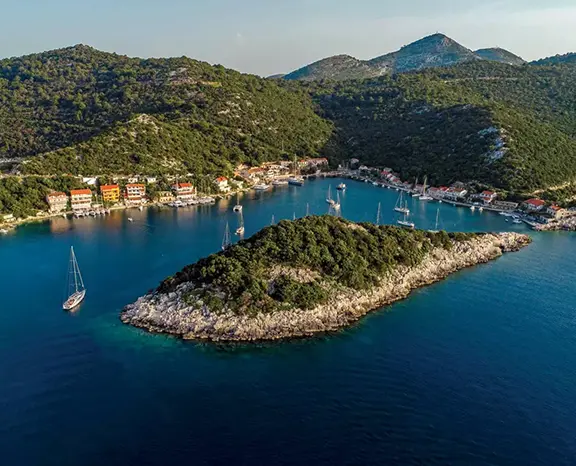
15 nm southeast from Marina Frapa Rogoznica to Krknjaši Bay between Veli and Mali Drvenik. Glass-water swim anchorage 4 nm west of Trogir, sand floor at 3-6 m, holding excellent. Three small Veli Drvenik konobas hang free buoys with dinner ashore.

Udaljenost

8 NM

Plovidba

~1,6 h pri 5 čv

Ukratko

Ruta ukratko

Najbolja sezona

svibanj – početak listopada (vrhunac lip – ruj)

Trajanje

14 dana

Polazak

Rogoznica

Plovno područje

Sibenik

Sažetak rute

Kliknite bilo koji dan za povratak na kartu i njegove fotografije, priču i savjet za vez.

Cijela priča

Putovanje dan po dan

Imenovana sidrišta, savjeti za vez i prijedlozi aktivnosti za svaku etapu tjedna — karta vas prati dok skrolate.

Dan 1 / 14
Veli Drvenik
1
Dan 1

RogoznicaVeli Drvenik (Krknjaši Bay)

Out of Marina Frapa Rogoznica, 15 miles southeast along the open coast and into the channel between Veli Drvenik and Mali Drvenik. Krknjaši is a swim anchorage: shallow with a pale sand floor at 3–6 metres, holding excellent. Three small restaurants on Veli Drvenik (no road access — boat or foot only) lay free mooring buoys for guests. Day 1 settles the crew, delivers a quiet first night before the route turns south.

Što raditi

Anchor on the sand floor in 4–6 m and swim

Walk the 30-minute headland loop on Veli Drvenik

Order grilled fish at a Veli Drvenik beach restaurant

Sample the local Plavac Mali at a quayside table

Watch the open-Adriatic sunset from the deck

Savjet za vez

Anchor in 4–6 m on excellent sand holding. Free restaurant buoys also available with dinner ashore. Bay is sheltered from N, NE, E, S and SE; exposed only to W and NW.

Milna
2
Dan 2

Veli DrvenikMilna, Brač

Twelve miles east-southeast across the Brač Channel into Milna. The bay has been a working harbour since the Venetian era, the entrance unmistakable — the 17th-century parish church on the inner quay, stone houses stepping back from the water. Stern-to mooring with own anchor on the inner town quay for a modest harbour fee. Brač is famous for the white limestone (the same stone used for Diocletian's Palace) and lamb under the peka, the village's three-hour Sunday lunch tradition.

Što raditi

Order lamb under the peka three hours before dinner

Walk to the parish church on the inner quay

Anchor with stern line to rocks in the outer bay

Sample Brač olive oil at the village agricultural cooperative

Dinghy 3 nm north to Bobovišća for a glassy sunset swim

Savjet za vez

Stern-to on the inner town quay with own anchor — modest harbour fee, water and power on the central stretch. Open SW to W; if afternoon Maestral builds above 15 kn, the inner quay stays comfortable.

Palmižana
3
Dan 3

MilnaPalmižana, Hvar

Fifteen miles southeast across the Hvar Channel into the Pakleni Islands. Palmižana sits on the eastern side of Sv. Klement, the largest islet in the cluster, with stern-to lazy-line slots at Palmižana ACI Marina (book online for July–August). South-side coves Vinogradišće and Tarsce are the comfortable W-gradient alternatives. Afternoon ritual: Meneghello family's 1906 botanical garden, dinner at one of the four konobas, snorkelling over the submerged Roman amphorae off the western shore.

Što raditi

Snorkel over the Roman amphora field on the western shore

Walk Meneghello's 1906 botanical garden

Anchor with line ashore in Vinogradišće if the marina is full

Take the water taxi across to Hvar Town for the evening

Walk the path across Sv. Klement to Vlaka Bay

Savjet za vez

ACI Marina Palmižana stern-to with lazy lines, online booking essential for July–August. If full, anchor in Vinogradišće cove (south side, sand and weed, line ashore standard).

Komiza
4
Dan 4

PalmižanaKomiža

Twenty miles southwest to Komiža, the working fishing port on the western side of Vis. Vis is the most westerly inhabited Croatian island and the 1989 lifting of its closed-zone military status is still visible. Stern-to with own anchor on the inner basin (sand and weed, mostly good holding) — outer wall open to SW swell. Konoba scene runs to grilled bogueroni and the indigenous Vugava white. Tito's Cave on Mount Hum is open as a site.

Što raditi

Hike up Mount Hum (587 m) to Tito's WWII cave

Walk the working fishing fleet on the eastern harbour

Order grilled bogueroni and a glass of Vugava at a konoba

Visit the Fishermen's Museum in the Venetian tower

Watch the open-Adriatic sunset from the harbour wall

Savjet za vez

Stern-to with own anchor on the inner basin of Komiža town quay. If SW gradient above 15 kn, push 6 nm north to Vis Town in St. George Bay.

Vela Luka
5
Dan 5

KomižaVela Luka (Korčula)

The day is dictated by the sun angle inside the Blue Cave on Biševo (09:00–11:00, official tender ferry, no private dinghies). Then short hop east to Ravnik islet and the Green Cave (open to private dinghies, easier and quieter). By early afternoon the route pushes 18 miles east to Vela Luka. Excellent shelter from N to E, full town services, fuel pump at the western end. Konoba dinner runs on žrnovski makaruni.

Što raditi

Queue for the Blue Cave tender between 09:00 and 10:30

Dinghy into the Green Cave at Ravnik

Sail past the south face of Vis on the leg east

Order žrnovski makaruni at a Vela Luka konoba

Walk the Vela Luka waterfront promenade at dusk

Savjet za vez

Vela Luka offers stern-to with own anchor on the long town quay — modest fee, water and power, fuel pump at the western end. Bay is fully sheltered from N, NE and E.

Zaklopatica
6
Dan 6

Vela LukaLastovo (Zaklopatica Bay)

Fourteen miles south takes you to Lastovo. Zaklopatica is the natural overnight: U-shaped bay with five family-run konobas that maintain free mooring buoys for guests who eat ashore. Lastovo's signature dishes are the local lobster (jastog) and šporki makaruli. Lowest light pollution in Croatia — Milky Way directly overhead before midnight.

Što raditi

Pick up a konoba's free buoy in exchange for dinner

Order Lastovo lobster (jastog) or šporki makaruli

Walk the path inland to the Lastovo Town fumari (chimney stacks)

Snorkel the islet at the bay entrance

Stay on deck for the Milky Way after midnight

Savjet za vez

Free konoba mooring buoys at Zaklopatica — confirm with the konoba on arrival, dinner reservation locks the buoy. Bay is fully sheltered from N to W; if SE forecast above 15 kn, move 4 nm south to Skrivena Luka.

Mljet
7
Dan 7

LastovoMljet (Polače)

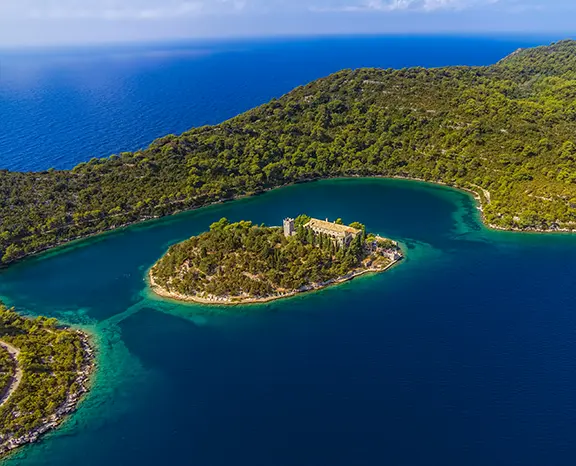
Twenty-two miles northeast takes you to Polače, the long fjord-like inlet on Mljet's north coast. The bay is one of the best-sheltered overnight options on the entire south Croatian coast. Pick up one of the green Park mooring buoys (overnight fee paid at the ranger kiosk, includes Park entry). The remains of a 4th-century Roman complex sit metres from the waterfront. From Polače a 30-minute walk leads to Veliko Jezero and the Park ferry to St. Mary's monastery.

Što raditi

Pick up a Park buoy and pay the ranger on arrival

Walk through the 4th-century Roman complex on the waterfront

Take the Park ferry to St. Mary's monastery on Veliko Jezero

Hike the 9 km lake-loop trail through the National Park

Swim in the saltwater lakes

Savjet za vez

Polače uses paid Park mooring buoys (current 2025 rate around €40/night including crew Park entry).

Dubrovnik
8
Dan 8

MljetDubrovnik

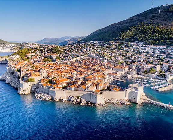
Twenty-four miles southeast to ACI Marina Dubrovnik in Komolac, set up the long fjord-like Rijeka Dubrovačka river estuary. Lazy lines, water and power on every berth, fuel pontoon. Old Port is a daytime tender stop only — exposed to S gradient. Bus 1A or taxi to the Pile Gate of the Old City in 15 minutes. The walls walk is mandatory: 1.94 km circuit, 90 minutes.

Što raditi

Walk the 1.94 km Old City wall circuit before sunset

Take the cable car up to Mt. Srđ for the panorama

Eat down a Prijeko side street, off the main Stradun

Visit the Rector's Palace and the Franciscan cloister

Stand a drink at Buža bar, on the rocks outside the south wall

Savjet za vez

ACI Marina Dubrovnik in Komolac is the only practical overnight — book ahead in season. Old Port is a daytime tender stop only.

Okuklje
9
Dan 9

DubrovnikMljet (Okuklje)

Twenty miles northwest to Okuklje on Mljet's southeast coast — outside the National Park boundary, no Park fees, three family konobas and a tight U-shaped bay that takes maybe twenty boats. The konobas hang their own free mooring buoys. Black risotto cooked with cuttlefish ink is the standby.

Što raditi

Pick up a free konoba buoy and book dinner ashore

Order black risotto (crni rižot) cooked with cuttlefish ink

Walk the headland path for the view down to Korčula

Swim straight from the boat in flat water

Sleep with no town noise — the quietest stop of the route

Savjet za vez

Free konoba buoys at Okuklje, dinner reservation locks the buoy. Bay is fully sheltered N, E and S; only NW gradient above 18 kn pushes any noticeable swell.

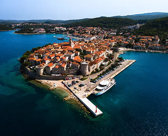
Korcula
10
Dan 10

OkukljeKorčula Town

Fifteen miles northwest along the Pelješac Channel to Korčula Town. ACI Marina Korčula on the eastern side offers full services with lazy lines; town quay on the western side accepts stern-to but is exposed to W Maestral. Old Town fits in the palm of your hand, layout famously the precursor to Venetian radial grids. Moreška sword-dance Mon and Thu evenings 21:00.

Što raditi

Watch the Moreška sword dance (Mon and Thu evenings in season)

Walk the Old Town at dusk after the ferries leave

Climb the bell tower of St. Mark's Cathedral

Visit the (debated) Marco Polo House

Pair dinner with a glass of indigenous Grk white from Lumbarda

Savjet za vez

ACI Marina Korčula on the eastern side is the all-weather option. Town quay is exposed to W Maestral.

Jelsa
11
Dan 11

KorčulaJelsa

Twenty-three miles northwest from Korčula across the Hvar Channel into Jelsa. The town quay accepts stern-to with own anchor (good holding in mud and sand), and a small marina on the eastern side handles boats that need lazy lines. Jelsa is the working heart of Hvar's interior agriculture: the lavender belt and the UNESCO Stari Grad Plain.

Što raditi

Bike the 3 nm coast road to Vrboska’s canal-bridged old centre

Walk inland through the UNESCO Stari Grad Plain

Order Bogdanjuša white at a back-lane konoba

Sample Hvar lavender oil at a producer in season

Climb up to the Tor watchtower for the channel view

Savjet za vez

Stern-to on the Jelsa town quay with own anchor — modest harbour fee, water and power. Small marina on the eastern side has lazy lines.

lucice
12
Dan 12

JelsaLučice Bay (Brač)

Ten miles north across the Brač Channel to Lučice, immediately east of Pučišća. No town — uninhabited headland walled by white limestone cliffs and pine forest, two seasonal beach restaurants with free buoys. The white limestone of Brač gives the seabed its characteristic pale floor; visibility runs to 20 metres on a calm summer day.

Što raditi

Pick up a free restaurant buoy in the central cove

Snorkel over the white limestone seabed (20 m visibility)

Order grilled fish and Plavac Mali ashore

Dinghy 1 nm west into Pučišća to see the working stone-mason yards

Stand-up paddle the headland coast at sunrise

Savjet za vez

Free restaurant buoys at Lučice — dinner ashore secures the buoy. Bays sheltered from N, NE and E; exposed to S.

Maslinica
13
Dan 13

Lučice BayMaslinica

Fourteen miles northwest to Maslinica, the deep S-shaped natural harbour at the western tip of Šolta. Mooring split between Martinis Marchi Marina on the south side (lazy lines, baroque-castle hotel) and the village quay on the north side. Šolta is the closest island to Split (15 miles out) but the quietest in the central Dalmatian group.

Što raditi

Walk into the Martinis Marchi castle courtyard

Order the Dobričić red, Šolta’s indigenous grape

Dinghy across to Stipanska island for the swim path

Sample Šoltansko olive oil at the village shop

Watch the sunset from Polebrnjak islet at the bay entrance

Savjet za vez

Martinis Marchi Marina (south side) has lazy lines — book ahead. Village quay (north side) takes stern-to with own anchor. Bay fully sheltered from S, SW, W and NW.

Rogoznica
14
Dan 14

MaslinicaRogoznica

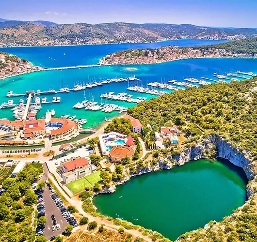
Final leg: 15 miles northwest from Maslinica back into Marina Frapa Rogoznica. Saturday handover protocol: boat back at base by 09:00, fuel topped, holding tanks emptied, decks rinsed, inventory checked. Course passes the Drvenik islands and the south coast of Šolta. With fuel pumped and inspection clear, walk the path to the Dragon's Eye Lake on the southern tip of Rogoznica peninsula one last time.

Što raditi

Top up fuel and pump out before the 09:00 inspection

Walk the path to the Dragon's Eye Lake

Stand a long lunch at the marina hotel restaurant

Walk the small old quarter on Rogoznica peninsula

Sample local olive oil at a village shop

Savjet za vez

Return into Marina Frapa Rogoznica per your charter contract. Saturday handover window 08:00–09:00; arrive by 17:00 Friday if your contract specifies night-before return.

Zaplovite ovom rutom na vlastitom charteru

Provjerite raspoloživost iz polazne marine, usporedite plovila i osigurajte svoj tjedan online — uz besplatno otkazivanje.